SAMYUNG GPS PLOTER - Ελληνικό menu και ενσωματωμένη κεραία GPS και χάρτες
![]()
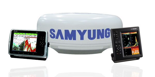
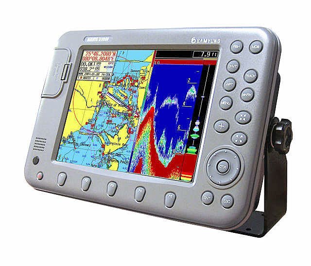
SAMYUNG GPS PLOTER Με Ελληνικό menu και ενσωματωμένη κεραία GPS και χάρτες
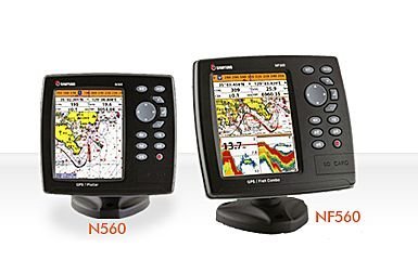
| <N560>Size : 164 mm(H) × 183 mm(W) × 74 mm(D) Display : 5.6" diagonal, TFT color, 480 × 640 pixels Supply voltage : 10 to 34 V DC Supply current : 13.8 V, 0.9A min - no backlighting, 2A max- full backlighting Operating temp : -10℃ to 50℃ Alarms : Arrival radius, anchor, XTE, danger, too shallow, too deep, fish, temperature, temperature rate, low battery, low fuel(optional), loss of DGPS fix, radar guard zone, dangerous AIS vessels. Chart card : C-MAP™SD Card (NT-MAX, NT + or NT) User card : SD Card Waypoints : Up to 5000, with default or userdefined alphanumeric names up to eight characters. Routes : 100 Routes, with up to 100 points each Tracks : By time or distance, 10 track of 5000 points Chart datums : 216 Chart datums (see next page) One user-defined map shift. Chart scale : 0.2 to 500 nm for chart (chart dependent) down to 0.01 nm in plotter mode. NMEA : NMEA 0183 4800, 9600, 38400 baud, NMEA 2000 |
<NF560/F560>Size : 164 mm(H) × 183 mm(W) × 74 mm(D)
Display : 5.6" diagonal, TFT color, 480 × 640 pixels
Supply voltage : 10 to 34 V DC
Supply current : 13.8 V, 0.9A min - no backlighting, 2A max- full backlighting
Operating temp : -10℃ to 50℃
Alarms : Arrival radius, anchor, XTE, danger, too shallow, too deep, fish, temperature, temperature rate, low battery, low fuel(optional), loss of DGPS fix, radar guard zone, dangerous AIS vessels.
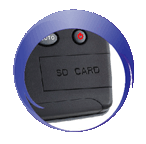
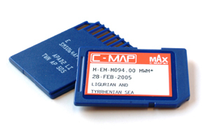
Chart card : C-MAP™SD Card (NT-MAX, NT + or NT)
User card : SD Card
Waypoints : Up to 5000, with default or userdefined alphanumeric names up to eight characters.
Routes : 100 Routes, with up to 100 points each
Tracks : By time or distance, 10 track of 5000 points
Chart datums : 216 Chart datums (see next page) One user-defined map shift.
Chart scale : 0.2 to 500 nm for chart (chart dependent) down to 0.01 nm in plotter mode.
NMEA : NMEA 0183 4800, 9600, 38400 baud, NMEA 2000
Depth range : 0m to 1.500m
Sonar output : Up to 600W RMS Daul frequency : 50/200kHz
Temperature : Range 0℃ to 37.7℃ Resolution oof 0.1℃ unit
| N560>5.6" High resolution TFT LCD 10 steps adjustable LED backlight Internal / external GPS antenna C-MAP NT MAX™ using DS card 128MB internal memory and built-in standard Samyung chart Individual button for navigation GOTO and MOB NMEA0183 interface (AIS, NAVTEX, DSC etc.) Multiple languages available including English, Chinese, Russian, Thai, Malay etc.
|
- ΞΑΝΘΟΠΟΥΛΟΣ ΝΙΚΟΣ
- email: This email address is being protected from spambots. You need JavaScript enabled to view it.
- mob : 6944813947
- fax : 2104610681
- ELECTROMARINA SERVICE


- ΞΑΝΘΟΠΟΥΛΟΣ ΝΙΚΟΣ
- email: This email address is being protected from spambots. You need JavaScript enabled to view it.
- mob : 6944813947
- fax : 2104610681
-
GPS PLOTER Με Ελληνικό menu και ενσωματωμένη κεραία GPS και χάρτες

GPS PLOTER Με Ελληνικό menu και ενσωματωμένη κεραία GPS και χάρτες
 New model


<N560>Size : 164 mm(H) × 183 mm(W) × 74 mm(D)
Display : 5.6" diagonal, TFT color, 480 × 640 pixels
Supply voltage : 10 to 34 V DC
Supply current : 13.8 V, 0.9A min - no backlighting, 2A max- full backlighting
Operating temp : -10℃ to 50℃
Alarms : Arrival radius, anchor, XTE, danger, too shallow, too deep, fish, temperature, temperature rate, low battery, low fuel(optional), loss of DGPS fix, radar guard zone, dangerous AIS vessels.
Chart card : C-MAP™SD Card (NT-MAX, NT + or NT)
User card : SD Card
Waypoints : Up to 5000, with default or userdefined alphanumeric names up to eight characters.
Routes : 100 Routes, with up to 100 points each
Tracks : By time or distance, 10 track of 5000 points
Chart datums : 216 Chart datums (see next page) One user-defined map shift.
Chart scale : 0.2 to 500 nm for chart (chart dependent) down to 0.01 nm in plotter mode.
NMEA : NMEA 0183 4800, 9600, 38400 baud, NMEA 2000<NF560/F560>Size : 164 mm(H) × 183 mm(W) × 74 mm(D)
Display : 5.6" diagonal, TFT color, 480 × 640 pixels
Supply voltage : 10 to 34 V DC
Supply current : 13.8 V, 0.9A min - no backlighting, 2A max- full backlighting
Operating temp : -10℃ to 50℃
Alarms : Arrival radius, anchor, XTE, danger, too shallow, too deep, fish, temperature, temperature rate, low battery, low fuel(optional), loss of DGPS fix, radar guard zone, dangerous AIS vessels.
Chart card : C-MAP™SD Card (NT-MAX, NT + or NT)
User card : SD Card
Waypoints : Up to 5000, with default or userdefined alphanumeric names up to eight characters.
Routes : 100 Routes, with up to 100 points each
Tracks : By time or distance, 10 track of 5000 points
Chart datums : 216 Chart datums (see next page) One user-defined map shift.
Chart scale : 0.2 to 500 nm for chart (chart dependent) down to 0.01 nm in plotter mode.
NMEA : NMEA 0183 4800, 9600, 38400 baud, NMEA 2000
Depth range : 0m to 1.500m
Sonar output : Up to 600W RMS Daul frequency : 50/200kHz
Temperature : Range 0℃ to 37.7℃ Resolution oof 0.1℃ unitN560>5.6" High resolution TFT LCD
10 steps adjustable LED backlight
Internal / external GPS antenna
C-MAP NT MAX™ using DS card
128MB internal memory and built-in standard Samyung chart
Individual button for navigation GOTO and MOB
NMEA0183 interface (AIS, NAVTEX, DSC etc.)
Multiple languages available including English, Chinese, Russian, Thai, Malay etc.Save a chart image on internal memory (128MB)
Save internal data on SD card
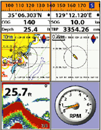
View and print saved data on SD cardAll C-MAP NT MAX™ features on high resolution LCD.
ALS information on chart plotter by connecting to compatible AIS receiver (NMEA0183)Choose a page / function by using icon for menu
Various icons
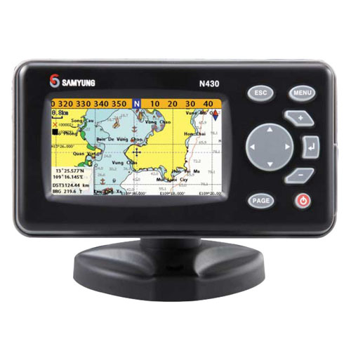
N 430 NEW
TEXNIKA ΧΑΡΑΚΤΗΡΙΣΤΙΚΑ
• Ελληνικό menu
• Μέγεθος οθόνης: 4,3 in
• Ανάλυση οθόνης (pixels): 480x272 pixels
• Οθόνη: TFT LCD
• Είσοδος/ Έξοδος ΝΜΕΑ 0183
• Τροφοδοσία 12/24 V
• 1 χρόνο εγγύηση επίσημης αντιπροσωπίαςGPS
• 10000 στίγματα με ονόματα /100 διαδρομές / 10 ίχνη με 15.000 σημεία ανά ίχνος
• Στην τιμή περιλαμβάνεται (ενσωματωμένος) ο αναλυτικός χάρτης C-MAP της ανατολικής μεσογείου- ΞΑΝΘΟΠΟΥΛΟΣ ΝΙΚΟΣ
- email: info@electromarinaservice.g
- mob : 6944813947
- fax : 2104610681
- ELECTROMARINA SERVICE


